White Mountains Area Maps
Note: All maps owned by Google and Google Earth. I do not own any of these maps.
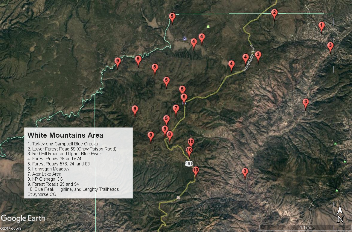
Map # 1: Overview of White Mountains Area
This map shows a general overview of the birding areas of Greenlee County in the White Mountain region. Some spots are labeled more than once to show the length of their routes better. The dotted vertical line on the east side of the map represents the Arizona and New Mexico state line.
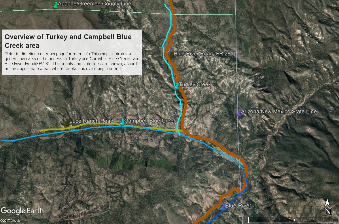
Map # 2: Overview of Turkey and Campbell Blue Creeks via Blue River Road/FR 281
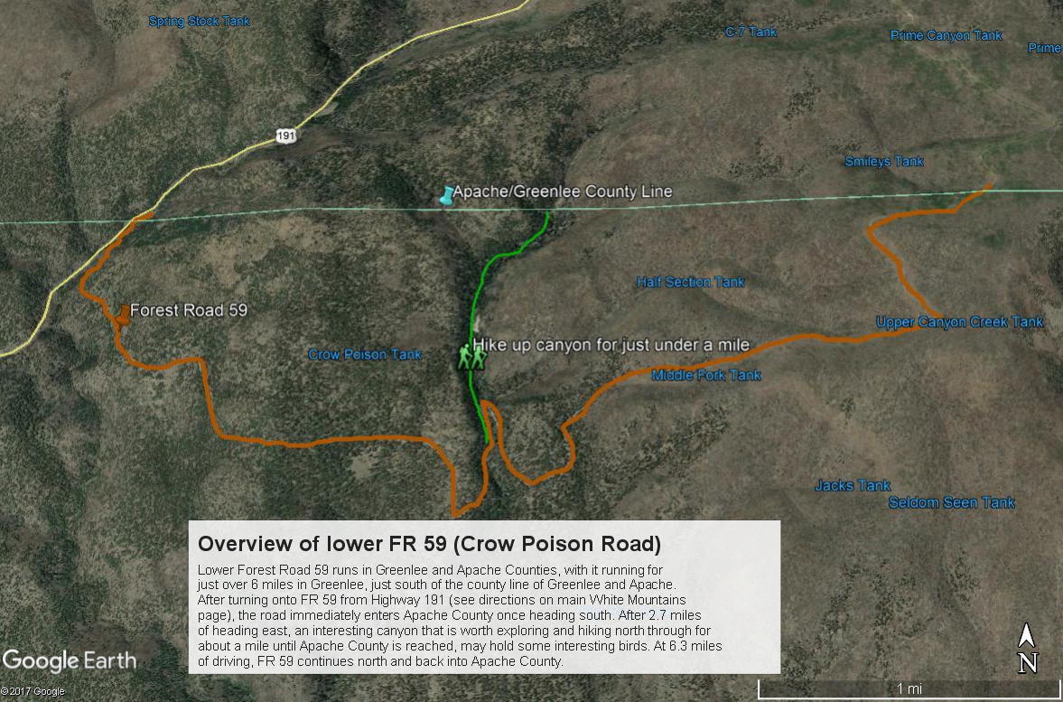
Map # 3: Overview of lower FR 59 (Crow Poison Rd)
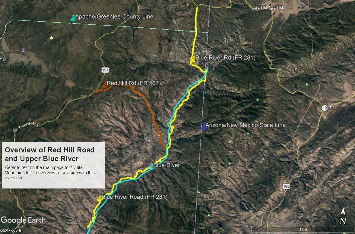
Map # 4: Overview of Red Hill Road and upper Blue River
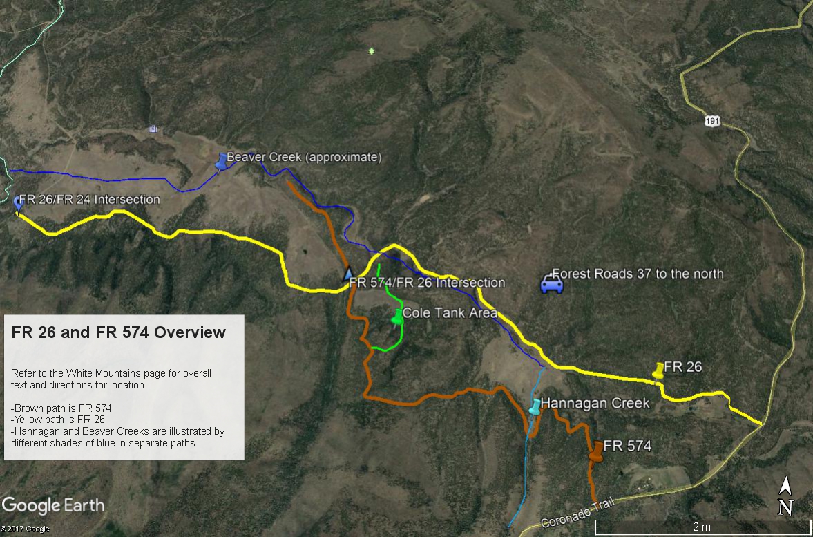
Map # 5: Overview of Forest Road 26 and Forest Road 574
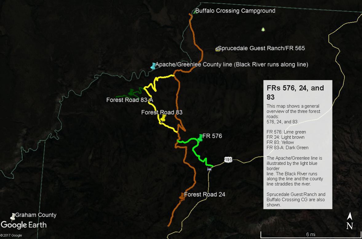
Map # 6: Overview of Forest Road 576, Forest Road 24, and Forest Road 83
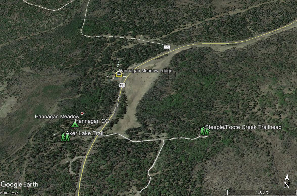
Map # 7: Hannagan Meadow area
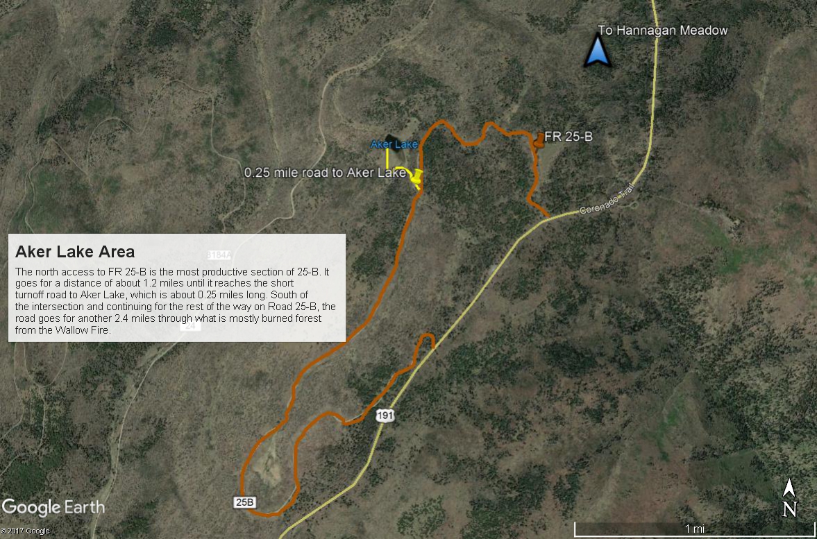
Map # 8: Aker Lake Area
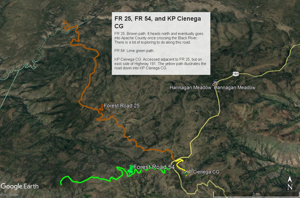
Map # 9: Forest Road 25, Forest Road 54, and KP Cienega Campground
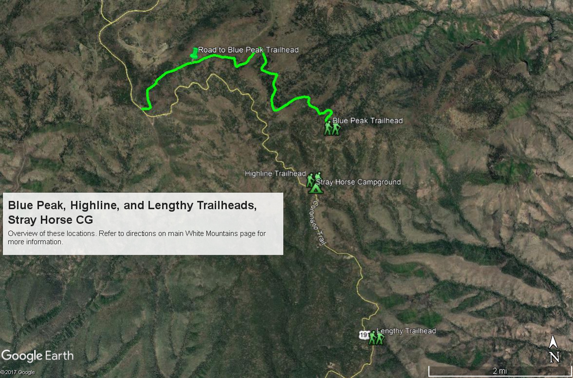
Map # 10: Overview of Blue Peak, Highline, and Lengthy Trailheads; and Stray Horse Campground
Back to White Mountains Area |