Highway 87 (from Mount Ord to south of Payson)
This section will start off the many birding areas to Birding In Gila County. It is the closest that Gila County is to Phoenix, and the pine and oak forest of Mount Ord is welcomed by birders who are wanting to escape the brutal heat of summer. Mount Ord is part of the Mazatzal Mountain range, and that range also extends to Slate Creek Divide and further north into Gila County. The forest diversity increases more at Slate Creek Divide, and even though a lot of the birds that can be found in the Mazatzals can be found elsewhere in Gila County more regularly, explorations of the mountain range are good to lock down. Foothills on the lower slopes of these mountains contain chaparral, juniper, and pinyon-pine. This area also has a share of desert scrub, small hints of semi-arid grassland, and extensive riparian forest at Tonto Creek via the community of Gisela. Combining a visit in this area to multiple habitats will make for a fun day of birding.

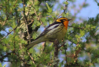
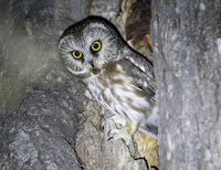
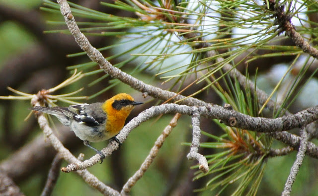
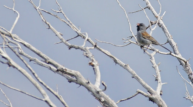
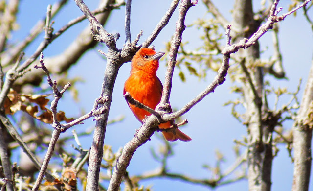
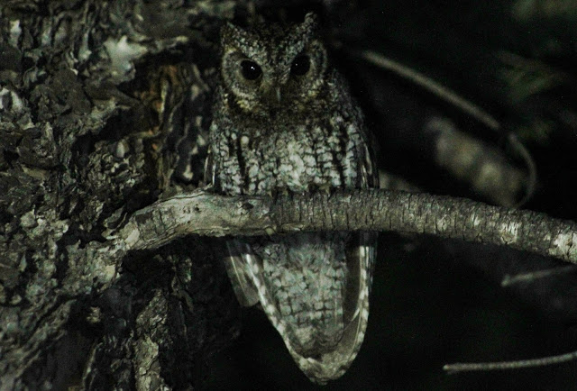
The breeding bird variety that can be found in this area include Gila and Ladder-backed Woodpeckers, Yellow Warbler, Yellow-breasted Chat, Yellow-billed Cuckoo, Summer Tanager, and Blue Grosbeak in the significant riparian woodland and adjacent desert to Tonto Creek via Gisela; Black-chinned Sparrow, Gray Vireo, Rufous-crowned Sparrow, Woodhouse's Scrub-Jay, Spotted Towhee, and Scott's Oriole in chaparral and juniper habitat; and Northern Pygmy-Owl, Spotted Owl, Flammulated Owl, Zone-tailed Hawk, Acorn Woodpecker, White-breasted Nuthatch, Brown Creeper, Olive Warbler, Grace's Warbler, Hepatic Tanager, Western Tanager, and Black-headed Grosbeak in the higher elevations of the Mazatzal Mountains that have coniferous and oak forest. This area is fun to bird and search for a different diversity of birds in the spring and fall migrations and in winter.
Directions: This birding area has scattered locations and junctions to where directions can be described from several locations. It is the closest Gila County birding area to Phoenix. In Arizona's birding history, a common reference point for going north up Highway 87 distance wise is where Shea Boulevard meets Highway 87 just outside of Fountain Hills. Traveling to Payson north on Highway 87 past Shea Blvd is 61.5 miles. Mt Ord's turnoff for example, the southermost direction point in this area, is 33.7 miles north of Shea on Highway 87, and 27 miles south of Payson. The second intersection that will be used for a direction point in accordance to the birding locations described below is the intersection of Highway 87 and Highway 188, which is 45.4 miles north of Shea Boulevard and 15.4 miles south of Payson. All of these birding locations will come in between where Mt. Ord crosses from Maricopa County into Gila County, and continuing north toward Payson.
BIRDING LOCATIONS
-Mount Ord: The turnoff to Mt. Ord is just north of mile marker 222 on the east side Highway 87/Beeline Highway; 33.7 miles north of the Shea Blvd/Highway 87 junction in Fountain Hills and 27 miles south of Payson. After the turn, the road turns to dirt and is Forest Road 626. FR 626 climbs for six miles to it's ending point toward the summit of the 7,128' Mt. Ord. Despite a few storter rougher stretches, the road is in decent shape and most vehicles can handle it. The habitat one can bird along FR 626 up to Mt. Ord consists of chaparral, juniper woodland, and pine and oak forest. FR 626 and Mt. Ord are in Maricopa and Gila Counties, with the higher majority of the area being in Gila County. The first three miles of the road go through chaparral and juniper before the pine and oak forests are reached at elevations of 6000' and higher. While the county line is close to the road, most of the time Gila is to the north of FR 626 and Maricopa is to the south. Look for Gray Vireo, Cassin's Kingbird, Blue-gray Gnatcatcher Woodhouse's Scrub-Jay, Juniper Titmouse, Bushtit, Black-chinned and Rufous-crowned Sparrows, and Scott's Oriole among others in these foothills below Mt. Ord. At three miles, FR 626 reaches it's first stand of tall pines, and FR 1688 heads south into Maricopa County. Continue past 1688 for a short distance to return to and stay in Gila County for the next three miles of FR 626 as it travels higher into pine and oak forest. Near the summit of Mt. Ord, the county lines come close to each other again. There is a gate that blocks public travel from driving up to the summit of Mt. Ord, and authorized vehicles are only permitted to do so. If climbing up to the summit, the only part of the road that is in Maricopa County is the last half-mile to the summit. The very western tip of the western slope of the mountan is also in Maricopa County, and is on steep and un-level ground. Birds to look for in the pine and oak forest at Mt. Ord in spring and summer include Northern Pygmy-Owl, Acorn and Hairy Woodpeckers, Western Wood-Pewee, Plumbeous Vireo, Violet-green Swallow, White-breasted Nuthatch, Western Bluebird, Olive Warbler, Grace's Warbler, Painted Redstart, and Hepatic and Western Tanagers. Fall and winter may bring birds to Mt. Ord such as Lewis's Woodpecker, Red Crossbill, Mountain Chickadee, Evening Grosbeak and Cassin's Finch.
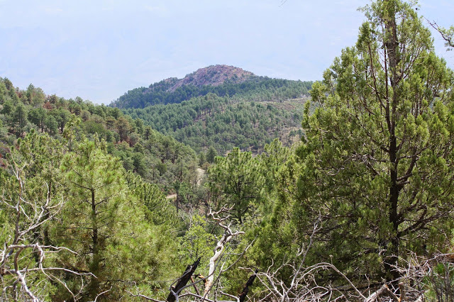
-Slate Creek Divide Area: For directions to this area, use the directions to Mt. Ord as a starter. Instead of turning on Mt. Ord's FR 626 on Highway 87, turn west adjacent to the Mt. Ord turnoff and onto the Sycamore Creek turnoff. Head west on this paved road for a mile and look for Forest Road 201 on the north side of the road. Take this dirt road, for which a high clearance vehicle is needed, for up to 9.7 miles to the Mount Peeley Trailhead, which is part of the Arizona Trail. In similar ways to Mount Ord, this area is in both Gila and Maricopa Counties. For most of the drive up FR 201, the county line goes along the road, and Maricopa is typically on the western side of the road, and Gila is on the right. Chaparral and juniper woodland fill this area until pine and oak forests are reached. Once the higher elevations are reached that have a mix of Douglas fir, pine, and oak, FR 201 extends north into Gila County, although Maricopa is close by and shortly to the south. With the lusher forest and the addition of the dominant tree here in these highest elevations being Douglas fir, it gives the Slate Creek Divide area more diversity than Mt. Ord. This is a location in the Mazatzal Mountains where one can find breeding habitat for species like Brown Creeper and Red-breasted Nuthatch. Before a devastating fire hit this area in the past, Red-faced Warbler used to breed here in good numbers, and it would be good to keep an eye out for them to return as a breeder in future years. Owling can be very good during spring and summer in these upper elevations at Slate Creek Divide.
-Highway 188 Rest Area: This rest area is gated off and has closed facilities, but it has taller trees than the surrounding area that is dominated by desert scrub and juniper. It may be a good place to check during migration. It is located on the east side of the intersecton of Highway 87 and Highway 188, barely on Highway 188. Going shortly further east on Highway 188 will access more close by birding areas that are described on this guide.
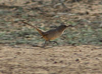
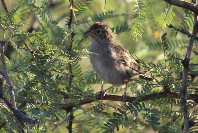
-Deer Creek Trailhead: This trailhead is located directly across from the junction of Highway 87 and Highway 188, and it is on the west side of Highway 87, 15.4 miles south of Payson. While this trail goes for miles and even up into the pine and fir habitat of Slate Creek Divide, most of the area near the trailhead and first miles of the trail consists of habitat being made up of upper desert scrub, chaparral, juniper, and some smaller sections of sycamore and cottonwood habitat along Deer Creek. During various times of the year, look for species like Gambel's Quail, Golden Eagle, Gila and Ladder-backed Woodpeckers, Bell's Vireo, Woodhouse's Scrub-Jay, Bridled and Juniper Titmouse, Bushtit, Crissal and Sage Thrashers, Townsend's Solitaire, Black-chinned Sparrow, Rufous-crowned Sparrow, Canyon Towhee, Scott's Oriole, and Lucy's Warbler.
-Un-named Road to APS Power Sub Station: On the east side of Highway 88, 14.3 miles south of Payson and just one mile north of Highway 188's junction with Highway 87, is an un-named dirt road that travels for about 2.5 miles east to an APS Power Sub Station. There are turns to this road from either direction of travel on Highway 87. The road travels along desert scrub, small hints of semi-arid grassland, and juniper. This area is worth a birding stop, and the grassy areas are worth checking for sparrows. Cassin's Sparrow has been found here before during northward breeding seasons for the species (Felipe Guerrero).
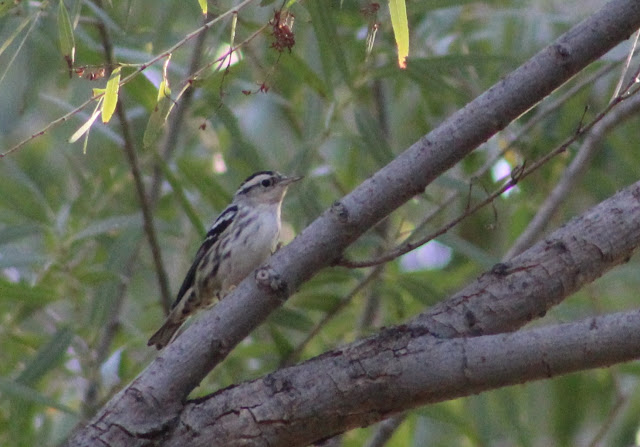
-Tonto Creek at Gisela: One of Gila County's best riparian areas is found along the stretch of Tonto Creek that is near Gisela. The turnoff to the unincorporated community of Gisela is on the east side of Highway 87 and is 11.6 miles south of Payson and is 3.8 miles north of Highway 87's junction with Highway 188. Take Gisela Road to the east for 4.3 miles until there is a turnoff on the south side of Gisela Road, which is a right turn onto a road called Tonto Creek Shores. Follow this road for a little over a mile and find a place to park after it turns to dirt. Tonto Creek is to the immediate east of here. Walk to the creek or follow this road to the south where it ends up at the creek. From where the southern part of the road meets the creek, Tonto Creek has amazing riparian habitat that continues south. Most of the time, the creek has crossings where water levels are more than ankle high. For the intrepid, bring an old pair of shoes that have little importance or rubber boots and explore the creek to the south. The creek and it's riparian woodlands can still be explored to the north adjacent to where Tonto Creek Shores Road turns into a dirt road, south of the Gisela neighborhoods. If going north any further more adjacent to neighborhoods, watch closely for private property. The habitat here has a variety that consists of cottonwood and willow riparian along the creek, a few open sections of the creek that are pondlike and have a surrounding cattail marsh, mesquite and hackberry stands nearby, desert scrub, and nearby chaparral and juniper slopes. Look for Yellow-billed Cuckoo, Indigo Bunting, Summer Tanager, Yellow Warbler, Elf Owl, and many more during spring and summer breeding season. Northern Beardless-Tyrannulet, being considerably north from it's expected range, has been a possible breeder here. In the migration periods and winter, this stretch of Tonto Creek has attracted rarities that have included Tennessee Warbler, Chestnut-sided Warbler, Black-and-white Warbler, a lowland Olive Warbler, Eastern Phoebe, Winter Wren, White-throated Sparrow, and American Dipper.
Back to Gila County Birding Areas |