Highway 60/77-North of Globe to Salt River Canyon and Canyon Day
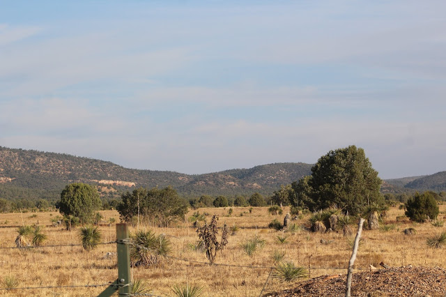
This area is the furthest east and northeast that Gila County will go, although other parts of the county to the west extend much further north. Making up this area are locations north of Globe along Highway 60/77 to the north of Salt River Canyon, and then back down in a southeast direction toward Canyon Day along Highway 73. A variety of habitats are found in this area that include desert scrub, riparian woodlands, open water at Seneca Lake, several tanks, chaparral, juniper and pinyon-pine woodland, grassland, pine and oak forest, and the tall cliffs and canyons in midst of the touristy Salt River Canyon. This is a birding area that will grow much more in the future because there are many locations that haven't been explored, and it is evident when looking over maps.
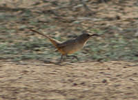
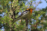
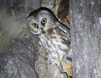
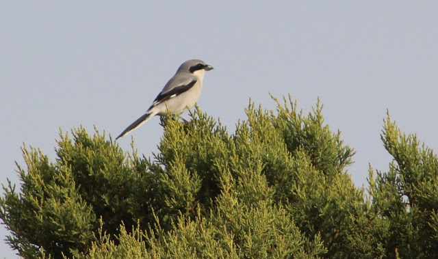
A variety of birds will be seen in this area that correspond to the habitats mentioned above. Stand out birds to look for include Pinyon Jay (this is the best area to see them in Gila County), as well as grassland birds in late fall in winter in the Canyon Day area. The riparian areas at Jones Water Campground and Seneca Lake hold great potential for finding interesting birds during migration and winter.
Directions: The base point for which directions will be given from in this area will be at the east side of Globe, at the Highway 60 East/Highway 77 North junction at the north side of 1700 E Ash Street/Highway 60 West. All of the directions that will be given will be in mileage to the north of this base point.
BIRDING LOCATIONS
-Seven Mile Wash via Forest Road 338: From Globe, drive north on Highway 60/77 for 16.1 miles and look for this road on the east side of the highway. There is a pull off and plenty of space to park. Walk to the southeast and go through a gate to access the area. Follow this road through upper desert scrub, chaparral, and juniper to Seven Mile Wash that contains several small but solid stands of willow and cottonwood riparian woodland.
-Jones Water Campground: From Globe, drive north on Highway 60/77 for 16.3 miles, and the turnoff for Jones Water Campground will be on the east side of the highway. This is a nice campground to bird in, and it lies in surroundings of juniper, desert scrub, and chaparral. There is a wash that runs through the middle of the campground, and sycamore, willow, and cottonwood make up a riparian area within the campground limits. This campground can be birded very easily by walking around the sites on a path that circles most of the campground.
-Timber Camp Campground: From Globe, drive north on Highway 60/77 for 25.8 miles, and the turnoff for Timber Camp Campground and Recreation Area will be on the west side of the highway. After pulling in, there are two ways to go: the campground will be on the left (south), and day use parking will be on the right (north). A fee is required to park or camp in the campground. Day use is free and one can park in the day use and walk around the entire recreation site, including the campground. This area is made up of pine and oak forest and it is a good location to look for species that favor that environment.
-Road 356 to San Carlos Apache Reservation tanks and grasslands: From Globe, drive north on Highway 60/77 for 29.1 miles, and the turnoff for this road, (Road 356) will be on the east/right side of the highway. The first 0.2 mile is on National Forest land before the road continues east onto the San Carlos Reservation lands. Be sure to have the $10 dollar permit that is needed if wanting to bird this area (see the birding area, San Carlos Apache Reservation, for more information on purchasing a permit). This road gives access to a few strips of plains grassland, pinyon-pine and juniper stands, several tanks that may attract waterbirds (if they have water), and some ponderosa pine and oak forest. It is a great area to observe Pinyon Jays in numbers. Directions will be described after pulling off of Highway 60/77 and will direct the birder for up to four miles on this road and will include routes to the tanks and through other habitats. Road 356 is in solid shape for most vehicles but it does have a few rough patches. After turning east off of the highway, head east on Road 356 for 1.3 miles. At this point, Highway Tank is on the west side of the road. Continue past Highway Tank for another 0.2 mile and look for a dirt road branching off to the east (left) of 356. Take this road (walking is suggested) for up to 2 miles or more, where there will be several tanks along the way in midst of a few patches of grassland as well as pinyon-pine and juniper woodland. Tanks Canyon Tank will be along the road at about 0.8 miles, and Brushy Basin Tank at about the 2 mile mark. Chestnut-collared Longspur and large flocks of Pinyon Jay have been detected along this route. Back on main Road 356, continue for another 1.1 miles from the last mentioned road, to total 2.6 miles of driving on Road 356 past the highway. On the west (right) side of the road is a trail that goes for 0.4 miles slightly to the northwest to Upper Highway Tank. Tracing right back to Road 356 adjacent to the Upper Highway Tank path, continue for another 1.1 miles to total 3.7 miles in driving east from the highway. At this point, Road 356 meets Sycamore Tank. From here, the road goes east for a much further distance through continued higher elevations that have more ponderosa pine forests as the road goes on.
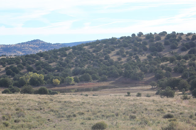
-Seneca Lake: From Globe, drive north on Highway 60/77 for 32.7 miles and turn west (left) for a short distance to access Seneca Lake. This small but productive lake is a part of the San Carlos Reservation, be sure to purchase a $10 day use recreation permit in Globe in order to access the lake (see the birding area, San Carlos Apache Reservation, for more information on purchasing a permit). Seneca Lake is surrounded by outskirted oak and juniper woodland, and the immediate surroundings of the lake itself include cattail marshes, lines of cottonwood and willow trees, and grassy/weedy areas. This lake has a lot of potential at all times of the year and would be worth checking at any time for surprises during migration or in winter. There are different paths that give access to most of the lake, as well as Phillips Mine Road that goes north of the dam and along a creek that feeds into the lake. Dusky-capped Flycatcher is one of the interesting birds that has been found here.
-Salt River Canyon: The tourist attraction of the Salt River Canyon is a popular destination for many people every year, especially for rafting along the Salt River. It is a scenic up and down route into a beautiful canyon, which has pinyon-pine and juniper habitat on the slopes above the canyon walls. This area is completely on two different parts of the Apache Indian Tribe land: the southern half is in the San Carlos Nation and the northern half is in the White Mountain Nation. From Globe, at 35 miles of driving north on Highway 60/77, the road starts to descend into the canyon. There are many switchbacks, and at 38 miles the road crosses the Salt River and also enters the White Mountain Apache Reservation. The Black and Salt River Recreation Area is a busy place at times of the year. For the White Mountain reservation, a separate permit is needed that is different than the one for the San Carlos Reservation. After crossing the Salt River in Salt River Canyon, a primitive road goes for a distance on the west side of the highway and just past the river crossing has sections that are worth birding and exploring in midst of lower elevation desert scrub. Special use permits are required for entering this area, and permits for the White Mountain Apache Reservation can be purchased further north at a Sinclair (Apache Mini Mart) gas station at the intersection of Highway 60/77 and Highway 73. At 42 miles past Globe, the drive concludes the upward climb through the switchbacks of the Salt River Canyon before Highway 60/77 levels out with even terrain. Pinyon Jay and Gray Vireo have been reported from this area, and if birding at the pull offs in midst of taking in views at the Salt River Canyon, species to keep an eye and ear out for include Peregrine and Prairie Falcons, White-throated Swift, and Canyon and Rock Wrens.
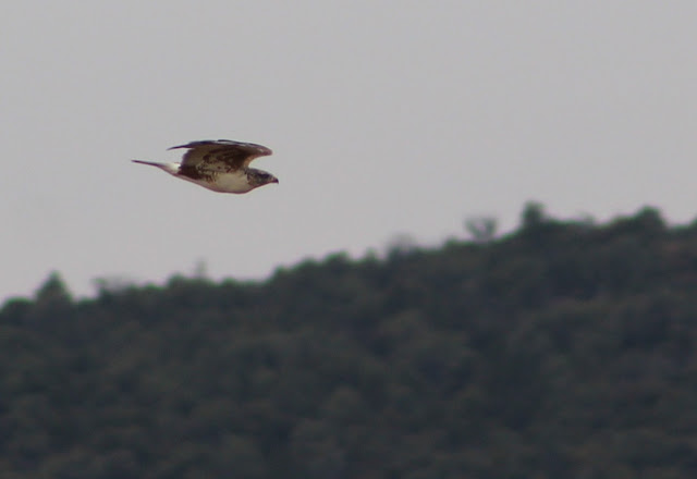
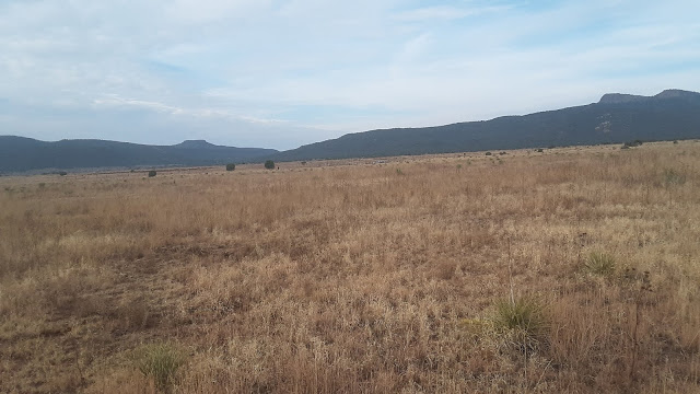
-Canyon Day area: Canyon Day is a small community on the White Mountain Apache Reservation that has a few solid patches of plains grassland habitat that can be birded with a permit. From Globe, travel on Highway 60/77 north for 62.5 miles to Highway 73, where there is a Sinclair Gas Station and the Apache Mini Mart at the northeast corner of the highway intersection. Purchase a $10 day use permit for the Reservation here. The Apache Mini Mart opens at 7 A.M. From here, travel east on Highway 73 toward Canyon Day. The bulk of the habitat along the route is pinyon-pine and juniper woodland. There are side roads along the route that are worth birding and exploring. From the Highway 60/77 intersection with Highway 73, take Highway 73 east for 22.5 miles to Kinishiba Road, which is on the north side of Highway 73. Take this road shortly north and look for branch-off dirt roads to the west. These branch off roads access the best grassland habitat in Canyon Day. The habitat here is worth birding in during late fall and winter to search for the potential in different longspurs, Sprague's Pipit, Short-eared Owl, Ammodramus sparrows, Rough-legged Hawk, and more. Ferruginous Hawk, Chestnut-collared Longspur, Grasshopper Sparrow, Eastern Meadowlark, and Mountain Bluebird have been found here in late fall. If going further north on Kinishiba Road toward the historical Kinishiba Ruins, one has to be accompanied by a guide at the nearby museum at Fort Apache, east of Canyon Day. From Canyon Day, one can go shortly east and northeast up into Navajo County and further northeast starting with the town of Whiteriver.
Back to Gila County Birding Areas |