Canyon Creek to Young Area
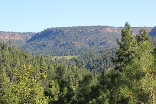
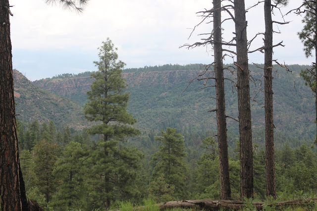
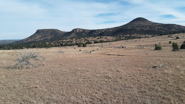
A variety of different habitats are found in this area which make this a fun section of Gila County to go birding in. Just below the Mogollon Rim are dense coniferous and oak forests, open meadows, forested canyon drainages, the smooth flowing waters of Canyon Creek, and rolling ridges that were once burned by fire that have regrowing vegetation among them. Coniferous and oak forest dominate the landscape enroute to Young, but when the Young area is reached, habitats of grassland and open pinyon-pine and juniper are added to the habitat variety. Although Young is full of private property, birding along the road or birding in grassland habitat in the near outskirts of Young have potential rewards. Although the locations that will be described below give birders a lot of ground to bird, there are still many locations to explore along this route and shortly south of Young.
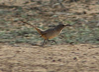
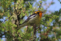
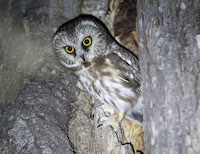
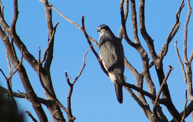
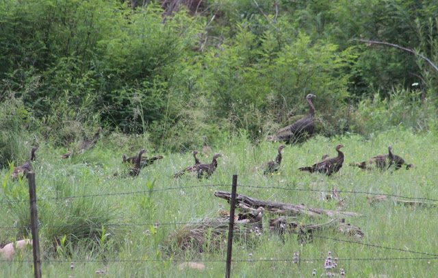
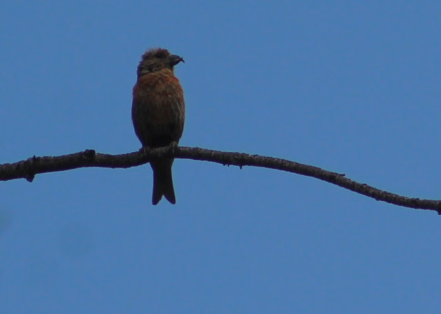
Birds to look for in this area among a big variety include Wild Turkey, Montezuma Quail, Northern Goshawk, Cooper's Hawk, Common Black-Hawk, Northern Pgymy, Flammulated, Northern Saw-whet, and Spotted Owls; Mexican Whip-poor-will, Common Poorwill, Broad-tailed and Rufous Hummingbirds (migration for Rufous), Purple Martin, Violet-green Swallow, Cassin's Kingbird, Greater Pewee, Hutton's and Plumbeous Vireos, Steller's, Woodhouse's Scrub, and Mexican Jays; Olive Warbler, Red-faced, Black-throated Gray, Grace's, and Virginia's Warblers, Painted Redstart, and Western and Hepatic Tanagers. The grassland areas near Young are worth exploring in late fall and winter for grassland species like Longspurs, Sprague's Pipit, and Rough-legged Hawk.
Directions: The base point for directions to this birding area will be from the Highway 260 and Forest Road 512 (also known as Globe/Young Highway and Highway 288) junction, where the well-maintained Forest Road 512 will travel south from the junction to access the birding areas that will be described. To get to the junction of Highway 260 and FR 512, head east from Payson on Highway 260 for 32 miles. Highway 260 will go into Coconino County above the Mogollon Rim for a few miles, and the first three miles of FR 512 south of Highway 260 are within Coconino County as well.
BIRDING LOCATIONS
Upper Canyon Creek Area
Upper Canyon Creek is a beautiful area that sits just below the Mogollon Rim, and is in the very northeastern part of Gila County. Not only is Canyon Creek a fun place to bird and explore, but there are many other birding locations close to Canyon Creek. What is neat about this area is that it can be driven roughly in a loop. Driving wise, this "loop" can be completed by taking Forest Road 512 south from Highway 260. After 3.2 miles of driving south of Highway 260 on FR 512, Forest Road 33 is on the east (left) side of 512. This will start the northern and western boundary of the loop, with FR 33 being the northern road in the loop and FR 512 being the westernmost boundary. Continue south on FR 512 for another three miles, and at 6.2 miles south of Highway 260, FR 512 will come into contact with Forest Road 188 on the east (left) side of 512. At this point, FR 188 then becomes the southern boundary of the loop. FR 188 travels for 5.3 miles and extends to the northeast where the road dead ends at private property at Canyon Creek's O.W. Bridge. Tracing back to FR 188's earlier route, it comes into contact with Forest Road 534 after 2.9 miles of driving after turning off of FR 512. At this point, FR 534 can be taken north for 2.2 miles to FR 33. At the FR 534/FR 33 intersection, take FR 33 for 2.4 miles to the northeast to where the road dead ends. From here, drive FR 33 back in the southwestern direction towards FR 534 but stay straight on FR 33 for it's entire length of 5.4 miles back to FR 512 to complete the "loop". The forest roads on this drive are dirt roads, but they are in good condition for most vehicles. This route is similar to a loop, but the eastern ends of FR 188 and FR 33 branch out as two eastern boundaries and really leave the a completed loop at the hands of FR 534. If following the exact route described, the driving total would be about 24 miles beginning with the start of FR 512 from Highway 260. For the descriptions of the birding locations, they will follow this route but will include additional driving directions for some of the locations.
-Forest Road 188: Turn onto FR 188 from FR 512, 6.2 miles south of Highway 260. You will start heading in the northeastern direction. After 0.2 miles stay straight on FR 188 as it intersects with the southeastern bound FR 738. After a mile of driving on FR 188, the road parallels a canyon that harbors thick stands of pine, fir, and oak on the south side of the road. The north side has brushier habitat, and parking and getting out of the car to bird along the road while walking further east will result in a solid diversity of birds. Greater Pewee, Purple Martin, and Red-faced Warbler are among the birds that are usually present at this location in spring and summer. After two miles of driving, look for Valentine Ridge Campground (eBird hotspot) on the east (right) side of FR 188. This is a nice campground to camp at, as it is in midst of tall ponderosa pines along a ridge of brushy habitat that overlooks the valley that harbors Canyon Creek to the north. Montezuma Quail have been detected in this area, and Northern Pygmy-Owl has been heard in the campground. Owling in the area at night in spring and summer may be productive on FR 188 in the mile before Valentine Ridge Campground and to the northwest direction below the campground in Valentine Canyon. Northern Saw-whet, Flammulated, Long-eared, and Spotted Owls have been dectected nearby. At 2.9 miles on FR 188, it interesects with FR 534 as stated in the directions above. Stay on FR 188 and continue right toward Canyon Creek. At 3.9 miles on FR 188, the road comes into contact and is paralleled closely by the beautiful Canyon Creek on the east for the next 1.4 miles until it dead ends at the private property gate at 5.3 miles total of driving on FR 188. This ending is by the O.W. Bridge, which is an eBird hotspot. Along the 1.5 mile stretch of Canyon Creek that FR 188 comes close to, there are open stands of pine and oak, grassy meadows and clearings, and impressive riparian habitat lining Canyon Creek that is highly made up of cottonwood trees.
-FR 534: Forest Road 534 serves as a connector between FR 188 and FR 33. It runs for 2.2 miles, and can be taken straight onto FR 188 for an additional 2.4 miles to equal out 4.6 miles of driving to the O.W. Bridge of Canyon Creek if going from FR 33 and not wanting to cover the southern half of FR 188. FR 534 has plenty of places to pull off and bird. During it's 2.2 mile length, a lot of the habitat is regrowth from a fire that passed through the area. Spotted Towhee is abundant. There are scattered stands of pine and oak along this road.
-FR 33: This road is 5.4 miles in length. It travels through an area that once burned for most of it's first and western-most 3 miles. At three miles of driving on FR 33 past FR 512, the road comes into an intersection with FR 534 and it becomes heavily forested for it's remaining 2.4 miles past FR 534 (which 534 is of course the access point to bird this whole area in a loop). Most of the birding locations that will be mentioned along this road will be east of FR 534. The only one west of FR 534 is Colcord Ridge Campground, which is barely east of FR 512 at the beginning of FR 33. This campground sits in midst of tall pine and fir forest and has good potential for a variety of forest birds. The remaining birding locations that will be described will be mileage from FR 512 if starting from the beginning of FR 33 without doing the loop. At 4.6 miles on FR 33, Airplane Flats Campground can be accessed. This is a peaceful spot to bird in, and it sits in midst of a tall stand of ponderosa pine. At 5 miles FR 33 crosses Canyon Creek. There is a fine mix of both coniferious and deciduous trees along the creek, giving the location good potential for avian diversity. Shortly north of this crossing is the popular Canyon Creek Fish Hatchery (eBird hotspot). There are trails near the creek crossing on the west side of FR 33 that follow the creek up toward the fish hatchery. At 5.2 miles, Upper Canyon Creek Campground is accessed. It's a small and pleasant campground that sits in midst of pine and oak forest and is worth birding. FR 33's eastern access ends at a closed gate at 5.4 miles, where only foot travel is permitted further along the path.
East Colcord Road to Young
-East Colcord Road/FR 291: From Highway 260, drive 3.2 miles south on FR 512 on turn to the west (right) onto Colcord Road/FR 291. It is directly across the street from FR 33 of the Canyon Creek Area. This is the eastern side of Colcord Road, and the eastern two to three miles have excellent birding, especially within the 1 to 1.5 miles. There are thick stands of pine and fir with some oak in the mix that make for what appears to be a very healthy forest. Look for a variety of forest birds. At 0.7 miles of heading west on Colcord Road from FR 512, look for a smaller road heading south. This is FR 291-G, and it travels through the thick forest for about a half mile before going along powerline cut openings. The side road is productive for the short distance up until the powerline cuts, but walking up Colcord for about 1 to 1.5 miles west of FR 291G will be productive for forest species. Colcord Road runs to the west for another twelve miles where it comes back out at Highway 260 several miles west of below the Mogollon Rim. Colcord Road has been split in half on this guide between this area and another area. To read more about the western half of Colcord Road, go to the previous area in Birding in Gila County-the Highway 260 Area (East of Payson to Mogollon Rim).
-Forest Road 200 (also known as Chamberlain Trail): FR 200 will be accessed off of FR 512 at 21.3 miles south of Highway 260. This road runs for 16 miles in the northwestern direction from it's intersection with FR 512. The southern eight miles of FR 200 will be covered here, while the northern eight miles are covered in the Highway 260 Area (East of Payson to Mogollon Rim). In this southern stretch of FR 200, there will be limited stands of taller pine and oak, and there will be more juniper and pinyon pine habitat, as well as a share of open grassland habitat. Drive on FR 200 past FR 512 for 1.7 miles. The road goes along some limited, but decent grassland habitat, including the Pleasant Valley Airstrip at 1.7 miles, which is a right turn to the east. Although the habitat is limited, it is worth checking for grassland birds. Chestnut-collared Longspur has been found here before. Take FR 512 for up to 4.9 miles, and on the west (left) side of the road there will be a turnoff for FR 935. Follow FR 935 with a high clearance vehicle for up to 3 miles from FR 200. The route access some grassland habitats in midst of pinyon-pine and juniper woodland. While there are cattle-grazed sections of the grasslands, some sections have good habitat worth checking or grassland species like Longspurs and Sprague's Pipit. At 7.1 miles of driving on FR 200 past FR 512 the tiny community of Haigler Creek is accessed. The nearby Alderwood Campground (eBird hotspot) is situated right by the community in a riparian and juniper woodland along Haigler Creek and has a small grassland nearby.
-Young: At about 26 miles of driving on FR 512 south of Highway 260, the road reaches the census-designated place of Young. Young is a small community that sits at an elevation of roughly 5,100'. This place has excellent habitat for grassland birds like Longspurs, Sprague's Pipit, and Short-eared Owl, but has horrible birding for birders because nearly all of the Young limits are on private property. Young and it's grasslands are surrounded by pinyon-juniper woodland. If passing through Young during the months of November through February, it doesn't hurt to keep an eye out for species like Rough-legged Hawk, Northern Shrike, or Short-eared Owl in early morning or evening. At 26.5 miles of driving on FR 512, Young has a 90 degree turn to the south to continue driving on FR 512. Go past this point to the west on Baker Ranch Road. Some of the roads going south of Baker Ranch Road, such as Zachariae Ranch Road, may be worth walking along during morning during winter months. Although the grassland habitat can't be accessed, longspurs and others do give flight calls that could be heard during the morning when they are more likely to be flying around. For another roadside birding spot, go back to the 26.5 mile spot where FR 512 takes the 90 degree turn in the southern direction. At 27.7 miles south of Highway 260 on FR 512, look on the east side of the road where there is a pond surrounded by trees. This can be a good birding spot at times where waterbirds or migrants may show up.
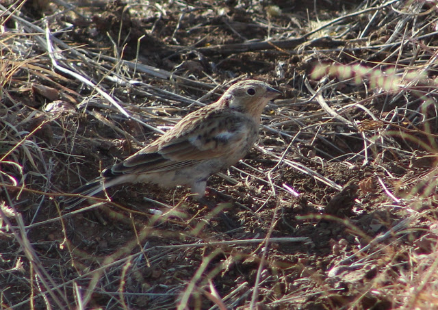
-Forest Road 130: This road starts at the very west side of Young. For directions, refer to the directions to getting to Young at the point where FR 512 takes a 90 degree angle. Stay straight on continue onto Baker Ranch Road instead of making the turn further south onto FR 512. Take Baker Ranch for 1.7 miles to the west, and FR 130 will be on the south side of Baker Ranch. Take 130 through one more small stretch of the Young community until it enters a woodland composed of oak and juniper habitat. Follow FR 130 for 3.1 miles and park. To the south is a rather small but seemingly productive grassland area to the south. During the late fall and winter months, this grass would be a good place to check for grassland species. One November expedition resulted in several each of Chestnut-collared Longspur and Grasshopper Sparrow, and also what was likely a remarkable-for-Gila County Baird's Sparrow.
Concluding, this birding area will be a work in progress for quite some time. It has many other locations that have yet to be explored. When they get explored, they will be added to this area.
Back to Gila County Birding Areas |