Tres Rios Overbank Wetlands Maps
*All maps property of Google.
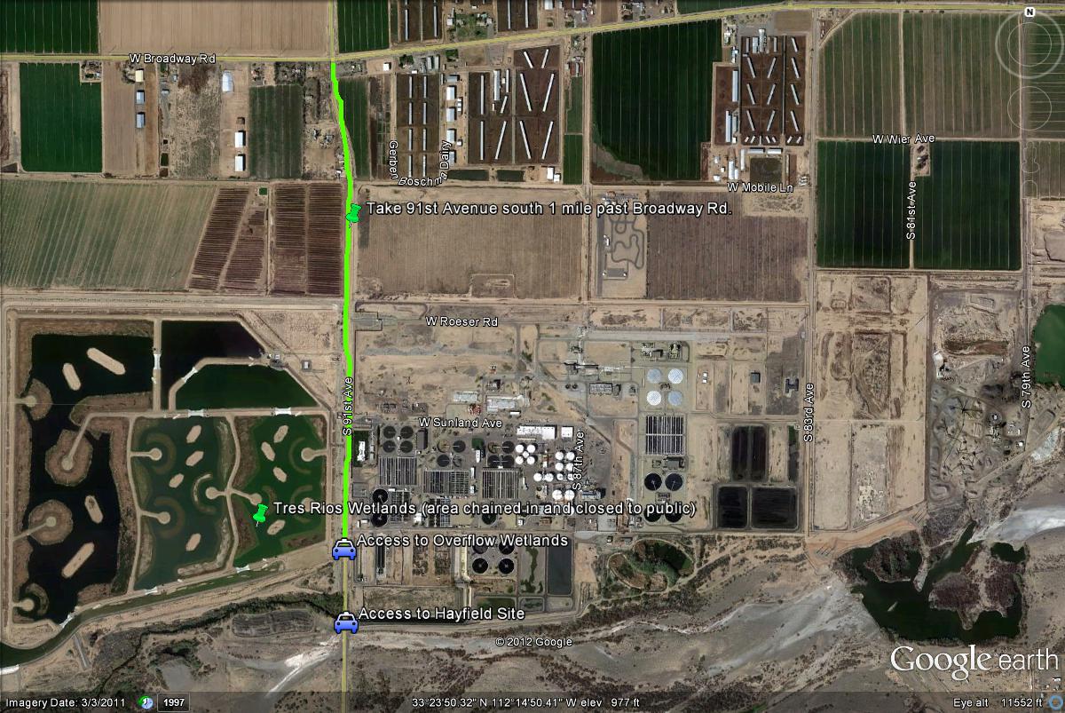
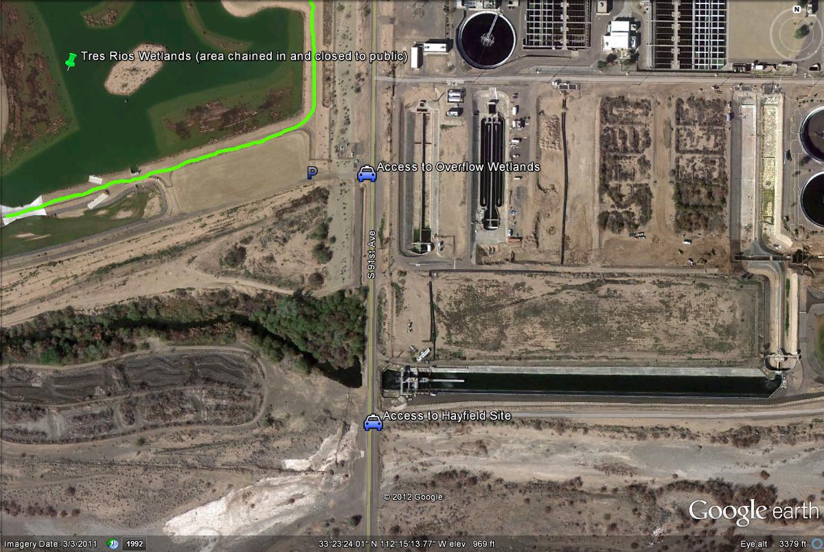
Map # 1: Getting to Tres Rios Overbank Wetlands.
To access the Tres Rios area, an easy way to get there would be to take the 91st Avenue exit south if on the I-10 freeway. Also, if coming from the Loop 101 south, one can merge east onto the I-10 freeway for a short distance to reach the exit for 91st Avenue. Once on 91st Avenue, take it south for five miles to the Tres Rios area. It is just north of Baseline and 91st, and about a mile south of Broadway and 91st. Once obtaining a permit from Tres Rios personnel, the parking area will be on the west side of 91st Avenue to access the Overbank Wetlands. When coming south down 91st Avenue (just south of Broadway), a large fenced in area will soon come into view which surrounds a noticeable wetland habitat. Once reaching the end of this fenced in area (which is the Tres Rios Flow Regulating Wetlands), the Overbank Wetlands can be reached just south of this fenced in area. You will see a "no tresspassing" gate preventing vehicle access, but once you have the permit, you have permission to park and bird the area by foot. The Tres Rios-Hayfield Site's access is only 0.15 miles south of the access point to the Overbank Wetlands, but the Hayfield Site is accessed on the east side of 91st Avenue.
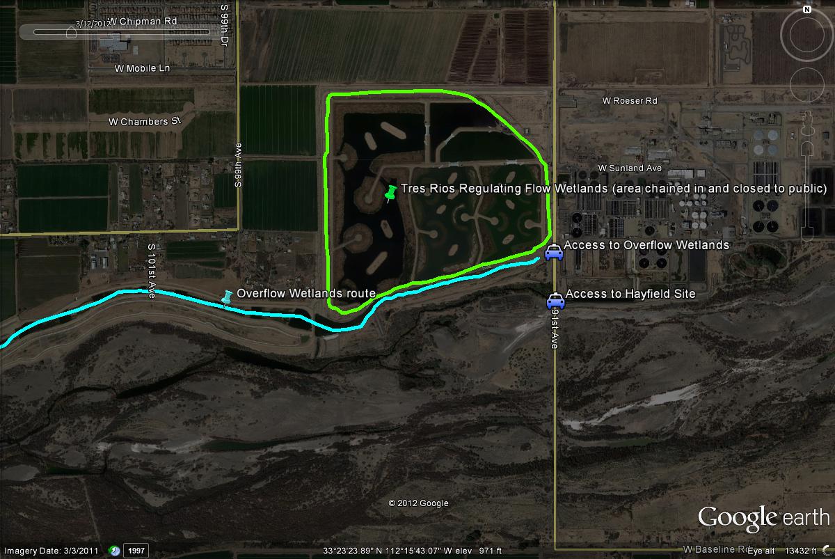
Map # 2: Accessing the Tres Rios Overbank Wetlands.
Map # 3: Overview of the Tres Rios Overbank Wetlands.
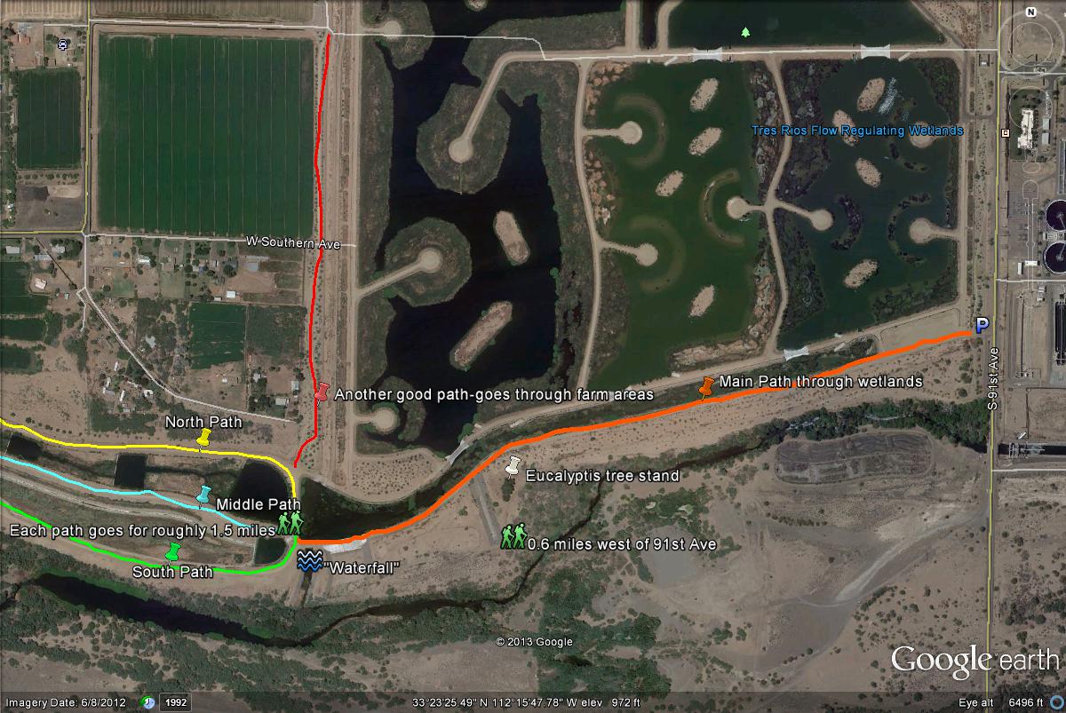
Map # 4: Tres Rios Overbank Wetlands Birding Route
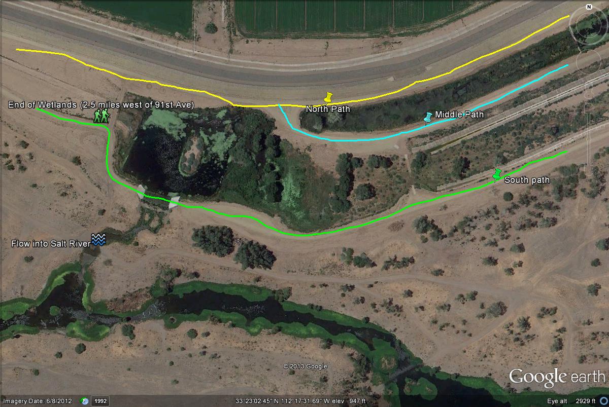
This map shows the routes of what the birder may take when birding at the Wetlands. The orange line shows the "Main Path" through the wetlands, which heads west to a junction where one may choose between three different paths. Once reaching this point, one has hiked about one mile west from 91st Avenue. The junction is also by a noticable "waterfall", which water from the Wetlands flows into the Salt River. Three paths/dirt roads: One to the north, middle, and south run for 1.5 miles west of this point to the western limit of the Overbank Wetlands, which concludes at 2.5 miles in length. Each of these paths hold productive birding, although certain species may seen better on one path. The "middle/central path" lines up with the main path after hiking through the first mile of the wetlands. The north path takes one through the backside of the many ponds of the wetlands and to the north of this path good agricultural habitat and farmlands are in good view. Take this path to view more birds found in grassland or fields, although it is still very productive for waterbirds. The middle/central path is best for seeing waterbirds. Between the middle and south paths are good habitats with extensive grassy and brushy habitats, as well as mesquite trees. Whether on the middle or the south path, one can often go into this habitat, which is excellent for ground-doves, sparrows, and meadowlarks. The south path is also good, and gives the birder better views of the Salt River to the south. Getting an overview of the Salt River may lead to good birding opportunities by searching that area south of the main trails along the Salt River. Because of the grassy habitat between the middle and south paths, it is very easy to consistently cross over these paths multiple times. These three paths all meet again at the very west end of the Overbank Wetlands, where good cottonwood riparian stands are found. Also, at the juntion of the three paths, there is another productive path that branches off to the northeast (highlighted by red line in map below). This path goes through farmland, fields, and agricultural habitats and is good for seeing raptors, sparrows and at times a Vermilion Flycatcher and Bendire's Thrasher.
Map # 5: A closer look at the west end of Tres Rios Overbank Wetlands
|