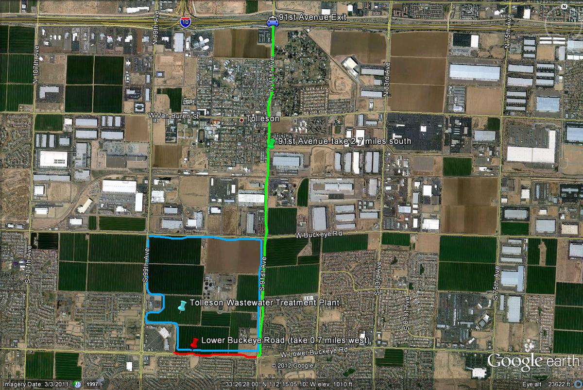
Map # 1: Getting to the Tolleson Wastewater Treatment Plant.
If on the 1-10 West (Papago Freeway), take the 91st Avenue exit. Head south on 91st Avenue for 2.7 miles to Lower Buckeye Road. Turn west (right) on Lower Buckeye Road for 0.7 miles. As you are driving west down Lower Buckeye Road for the short distance, you start to come up on a shopping center. Right before the shopping center, watch for a dirt road pulloff. Turn north (right) on this dirt road, and take your next right. Once continuing on this next right, park somewhere along the road and explore the area.
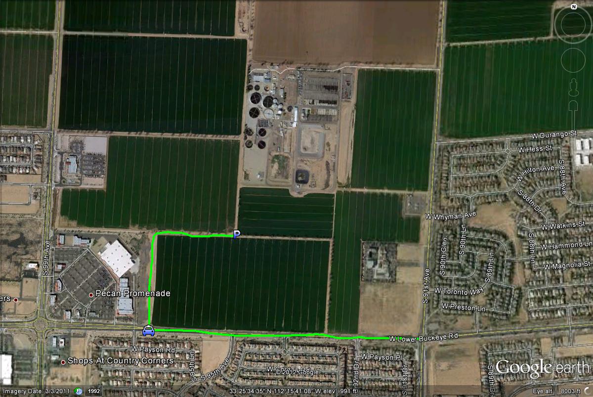
Map # 2: Accessing and parking at the Tolleson Wastewater Treatment Plant.