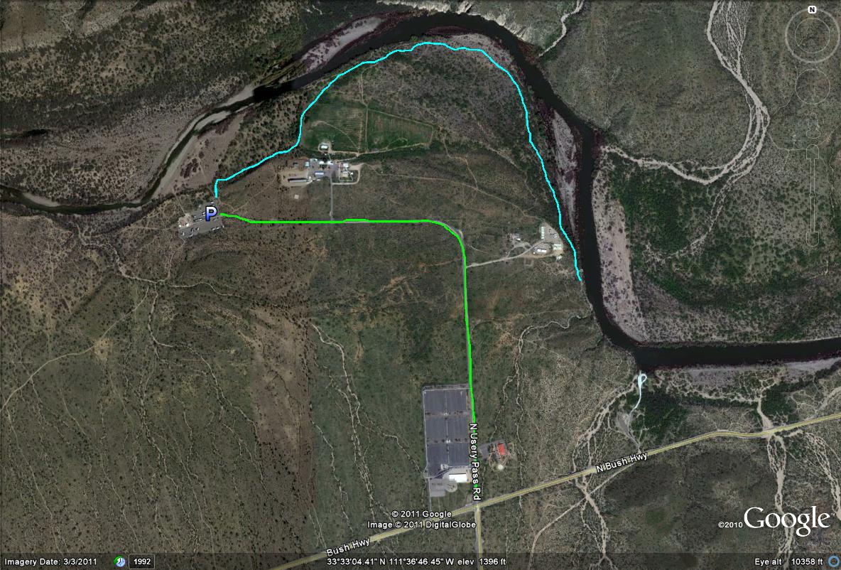
Goldfield Recreation Site Map
*All maps property of Google
Lime-green Path/line: Shows the entrance road to the Goldfield Recreation Site, which is signed N Usery Pass Road. This road is just over a mile to the parking area, and can have good desert birding up to the entrance of the recreation site. Harris's Hawks are reliably seen along this stretch, especially on the roadside telephone poles. Keep an eye out on the cactuses as well. A forest of Teddybear Cholla is passed too along this road, and is very neat to see.
Light-blue Path/line: This is the best and most recommended birding stretch at the Goldfield Recreation Site, which is east of the parking lot. Take the path well east until a noticable cottonwood grove is seen. Then, follow the excellent cottonwood habitat south to it's end as you go off the path a bit. By following the grove, the path is easy to remember. Good willow habitat is along the path as well, with excellent mesquite habitat. This stretch is about 1.5 miles, and is excellent birding.

|


