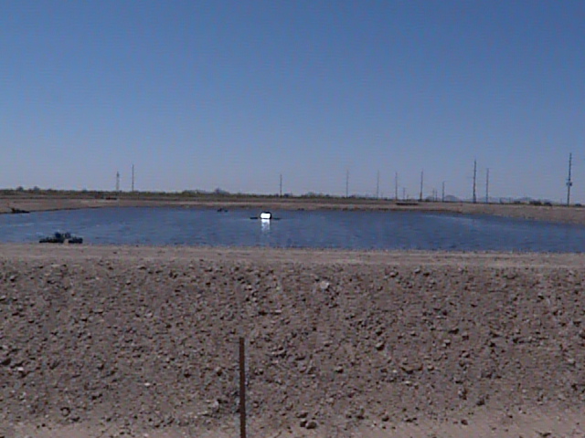
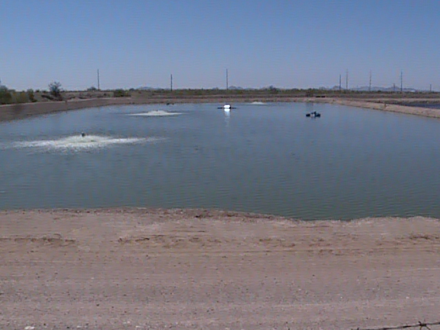
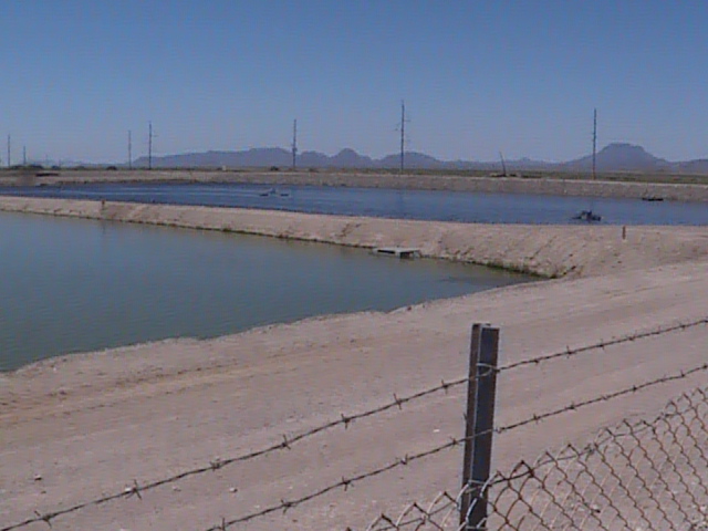
Gila Bend Sewage Ponds
Fast Flight Facts
Target Species: Shorebirds and waterfowl in winter and migration
Elevation: 700'
Habitat: Two sewage ponds with high water levels
Overall Birding Rating: 2
Difficulty: 1 (Easy)
Birding Type: Get Out and Scan
Facilities: None
Fees/Ownership: None/City of Gila Bend
Closest Town or City/How far from Phoenix: Gila Bend /51 miles southwest of Phoenix
Getting there: Accessed from the south side of Watermelon Road from a small dirt road pull off overlooking the ponds
Overview: The Gila Bend Sewage Ponds are located a few miles west of the Gila Bend Power Plant. Just like the power plant birding wise, this is another place that is worth coming too for a stop and scan.
Water levels here are deep, thus they aren't as good for shorebird variety. Phalaropes favor this spot and can often be seen in huge flocks at close distances, with most of them being Wilson's Phalaropes. The fall migration time would be the best time to observe them. In winter, this place is highly attractive to ducks, both diving and dabbling. This has even included a White-winged Scoter here, which is rare in Arizona. It was also productive on that day for a Wood Duck, American Wigeon, Northern Shoveler, Green-winged Teal, Canvasback, Redhead, Ring-necked Duck, Lesser Scaup, and Ruddy Duck along with the Scoter for a ten duck day. So this place is another top notch spot to give a "check" to. This location may also be very productive during swallow migration.
Birding Tip: Get out an scan, a scope is very useful. This place is somewhat similar to the Gila Bend Power Plant as far as trespassing goes-birders are allowed to park and look over the fence, but aren't permitted to go on the actual grounds. Here it is very easy to get a clean look at things, as most of the water is viewable without the fences being in the way.
Directions: To access the Gila Bend Sewage Ponds, drive west on Watermelon Road for 3.6 miles after turning onto Watermelon Road from the Old Highway 80 (which Watermelon is accessed about 1.7 miles from the very south end of the Old Highway 80 where the I-8 is located, between mile markers 1 and 2). While on Watermelon Road, pay attention to the roadside mileage signs, which the Sewage Ponds will be located between mile markers 3 and 4. Once to the sewage ponds, they will be on the south side of Watermelon Road on an obviously elevated surface and turnoff as well. On the east side of the ponds, there is a road/pull off one is allowed to drive on, but no trespassing is allowed past the gated fence. However, perfect views are provided from standing on this road just east of the ponds. One will pass by the Gila Bend Wastewater Treatment Plant along the way also, so both of these Gila Bend locations are very close to each other.
Pages:
Gila Bend Sewage Ponds Map
Gila Bend Sewage Ponds eBird Data
Scenes and Sights from the Gila Bend Sewage Ponds:
Back to Area 8-Arlington to Gila Bend |