Duncan and Franklin Area
Cottonwood and willow riparian habitat along the Gila River, Chihuahuan desertscrub, and agricultural fields make up the Duncan and Franklin Area for most of the habitat diversity. This is a productive birding area in all seasons. Sandhill Cranes are abundant in winter, passerine migrants are abundant in spring and fall, Common Black Hawk, Gray Hawk, and Mississippi Kite breed along the Gila River, and the Duncan Birding Trail is a must visit. Most of the birding locations are close to one another within this area, which creates a convenient and full day of birding.
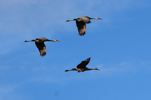
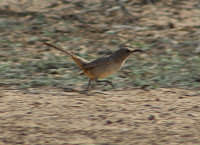
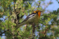
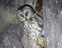
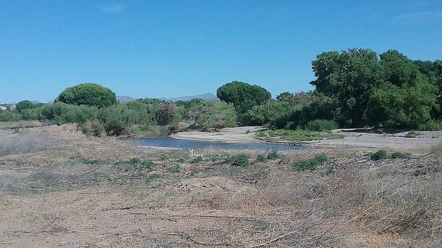
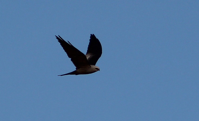
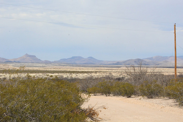
Birds and habitat you may see in Duncan and Franklin Area: The Gila River runs right through this area and has an impressive riparian corridor along it's entire length. Breeding birds to look for within the large cottonwood and willow stands along the river include Mississippi Kite, Common Black Hawk, Gray Hawk, Cooper's Hawk, Western Screech Owl, Barn Owl, Black-chinned Hummingbird, Gila and Ladder-backed Woodpeckers, Willow Flycatcher, Black Phoebe, Vermilion Flycatcher, Ash-throated and Brown-crested Flycatchers, Bell's Vireo, Lucy's Warbler, Yellow Warbler, Song Sparrow, Yellow-breasted Chat, Summer Tanager, Northern Cardinal, and Lesser Goldfinch. The habitat is also a great place for both migrating and wintering birds, and would be a good place to search for eastern vagrants. The 3,600' in elevation make this riparian corridor an interesting place to visit during the winter months. It may attract more birds typical of higher elevations in numbers such as Brown Creeper, Western Bluebird, occasional birds such as Downy and Hairy Woopeckers, and more. The Gila River may have waterfowl, herons, and shorebirds on it during different times of year, with winter being the best time to find waterfowl. The Duncan and Franklin area is also made up of agriculatural fields within farmlands. This habitat supports abundant Sandhill Crane in winter, as well as an assortment of raptors, blackbirds, both meadowlark species, sparrows, and at times, Eastern Bluebird. Birding fields at different times of year may support different species, such as shorebirds or other waterbirds in migration if fields are flooded. Lastly, Chihuahuan Desertscrub is another key habitat here. Throughout the year, look for typical southwestern desert birds in this habitat, such as Gambel's Quail, Greater Roadrunner, Verdin, Lucy's Warbler, Black-throated Sparrow, Abert's Towhee, Pyrrhuloxia, and Phainopepla. Other than the main habitats that have been described, the town of Duncan has many different trees thoughout town that will attract interesting birds. Brushy habitats along the side of riparian corridors or agricultural fields attract Crissal Thrasher and abundant sparrows in the winter months.
Area Elevation: Rougly 3,600'.
Base Point for directions: The base point for directions in this area will spot up at the Junction of Highways 70 and 75 in the center of Duncan. Every birding location mentioned within the area will have directions to that given location from the 70 and 75 Junction.
Area Maps: Duncan and Franklin Area Maps
Birding Locations:
1. Duncan Birding Trail: The Duncan Birding Trail is located right in Duncan, and it is has been established by community volunteers with support of the Town of Duncan. It is an incredible birding location, and may be Greenlee County's most productive birding spot in terms of species diversity observed. The Birding Trail has two sides to it, with a trail running on both the northwest and southeast side of Highway 75. Each side of the trail goes for about a half-mile in lengh, and both sides of the trail parallel the south side of the Gila River, which runs southeast to northwest along the stretch of the Duncan Birding Trail. Habitats found along the trail are willow and cottonwood riparian, brushy and weedy areas, agricultural fields, and neighborhoods with a high variety of trees. These habitats attract amazing bird diversity, and this trail is highly productive in all seasons. In the winter months, species include Sandhill Crane and raptors in the agricultural fields, abundant sparrows in the brushy sections along the trail, unpredictable numbers of waterfowl, and a variety of songbirds. Spring and summer yield Mississippi Kite, Common Black-Hawk and Gray Hawk as notable raptors in the area. There are many songbirds that breed within the Birding Trail. In spring and fall migration, this place will get attention from a variety of birds. Regular visits to this trail often reward birders with anywhere from 40 to 60 different species per visit. To get to Duncan Birding Trail, take Highway 75 north from Highway 70 for a short distance. The railroad tracks will be passed immediately. Before coming to a bridge that crosses over the Gila River, look for a dirt pull off on the right (southeast side) of Highway 75. There is a sign that reads "Birding Trail". Pull off here and park. Walk the Birding Trail southeast just south of the Gila River or on the levee path a little further south. The latter gives a better view of the area, both are worth covering. To get to the northwest side of the Birding Trail, cross Highway 75 and follow the path along the south side of the Gila River, which stays close to the river at all times.
Duncan Birding Trail on eBird
2. North side of Gila River via Old Virden Road: This section of the north side of the Gila River is easily accessed via Old Virden Road. It is adjacent to the Duncan Birding Trail to the south and on the east side of Highway 75. From Highway 70, take Highway 75 shortly north and drive over the bridge crossing the Gila River. Just north of this bridge, look for Old Virden Road on the right (east) side of Highway 75. Take Old Virden Road shortly east and look for a dirt road descending down into the cottonwood and willow riparian forest. Park off Old Virden Road here and walk down the dirt road, which will travel east from here. The dirt road/paths branch into many different directions on this north side of the Gila River and are worth exploring. Avoid private properties that are above the riparian corridor. The dense riparian habitats this area has to offer may be a much better bet for finding migratory, wintering, and resident songbirds throughout the year, as well as an overall diversity of birds.
3. Virden Highway, Old Virden Road, and Stagecoach Loop: These three roads combine for a productive loop drive for birding from a vehicle or stop-and-go-birding. Agricultural farm fields make this an excellent place to view Sandhill Cranes, raptors, meadowlarks, sparrows, blackbirds, and more. Reaching these roads is similar to reaching the previous two birding locations listed. Start by driving on Virden Highway, which branches off on a slight right east from Highway 75, about a half-mile north of Highway 70. The Virden Highway goes into New Mexico after a few miles of driving on it. Stay on the Virden Highway for 1.8 miles heading east until an intersection with Stagecoach Loop on the right (heading west). Follow Stagecoach Loop west for about a mile until it makes a sharp right turn and heads north. At this point, the road has turned into Old Virden Road. Follow Old Virden north for roughly 0.4 mile, and then take the Old Virden Road west for about 0.8 miles to return to Higway 75 and complete the loop. The Virden Highway has much faster traffic than Old Virden Road and Stagecoach Loop.
Stagecoach Loop on eBird

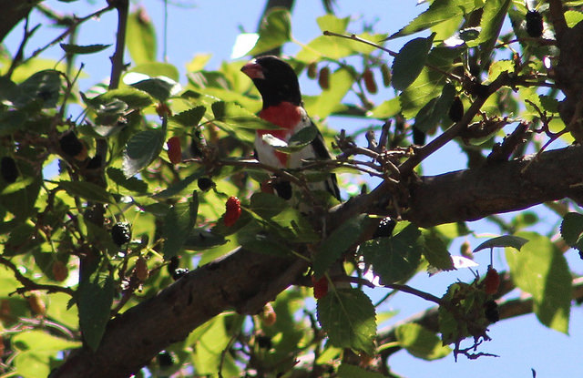
4. Centennial Park and East Avenue: Centennial Park is a small park in midst of a variety of tall trees in Duncan. It is worth checking for Inca Dove and migrants in season. East Avenue is a residential street in Duncan and at times is very productive for bird diversity, especially migrants and wintering birds. Rose-breasted Grosbeak has been found here. Centennial Park is on the south side of Highway 70 in Duncan, not even 900 feet east of the juction of Highway 70 and 75. East Avenue is a few hundred feet further east. Turn left onto the east side of 70 to access East Avenue, which starts off by having the Ranch House Restaurant leading off the road. Park nearby to bird East Avenue and Centennial Park. The Ranch House Restaurant has excellent dining and is highly recommended. If birding in Duncan for a day, it makes a great lunch or dinner stop.
Centennial Park on eBird
5. 4th Street/Airport Road: Frpm US 70 and Highway 75 Junction in Duncan, take 70 east to 4th Street in Duncan, which is about 0.6 miles. Follow this road, which quickly becomes Airport Road for it's remainder. Take this road for up to three miles before it enters private property. It travels through desert shrub for the majority, but towards the end, desert grassland may be accessed. There are areas maintained by Arizona Game and Fish out this way, and they look to be permissible for foot travel. The semi-arid desert grassland is worth birding, and Scaled Quail has been found here.

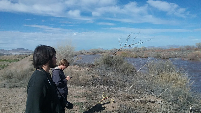
6. Franklin Pond: Continuing just south of Duncan is the census designated area of Franklin. It has excellent birding areas too. Following Highway 70 past it's intersection with Highway 75 through Duncan south for roughly 2.3 miles accesses views of a pond close to the road on the east side of Highway 70 in Franklin. This pond is in a farm on private property, but it can conveniently be viewed on the side of the road. Stay on the road and respect the property. Waterfowl and other waterbirds are regularly found here. Scan the sides of the pond for any potential shorebirds. Vermilion Flycatchers like this farm. The surrounding fields just north and adjacent to this pond are good for viewing Sandhill Cranes and raptors, induding possible Mississippi Kites in season.

7. Railroad Wash Road and Franklin Road: About 3 miles south of Highway 70 and Highway 75's juction, Railroad Wash Road is accessed on the east side of Highway 70. It is only a half-mile south of the previously mentioned pond. Another 0.4 mile south also accesses Franklin Road, also on the east side of US 70. These two roads can be traveled on in a loop road due to County Line Road on the east which connects Railroad Wash and Franklin Roads. Follow Railroad Wash Road for up to 2.1 miles east until in turns into County Line Road as it turns south toward Franklin Road. County Line Road is the state line of Arizona on the west and New Mexico on the east. Railroad Wash Road travels through agricultural fields during most of it's duration. The Gila River, which is north of the road at all times, closely borders Railroad Wash Road for the last half-mile of the eastern side of the road. The agriculture fields and riparian section of the Gila River on the very east side of Railroad Wash Road are worth birding. In 2016, a remarkable Upland Sandpiper was found along this road. The fields are private property as is a lot of property along this road. Once Railroad Wash Road becomes County Line Road, follow County Line Road south for a fifth of a mile. Turn right (west) onto Franklin Road and follow it back west to Highway 70 for two miles to complete the loop. Franklin Road has fields to scan also. Look for Sandhill Cranes, raptors, shorebirds if fields are flooded, and much more along these two roads.
Railroad Wash Road on eBird
8. Scordato Ranch Road: 5.1 miles south of the Junction of Highways 70 and 75 in Duncan, is Scordato Ranch Road on the west side of Highway 70. This is a primitive dirt road which isn't regularly maintained. It traverses through desert habitat and is good for species such as Verdin, Black-throated Sparrow, Black-tailed Gnatcatcher, and Pyrrhuloxia. Sagebrush Sparrow has been found here. The first half-mile to a mile of this road is worth birding, and the road eventually curves into New Mexico. To bird this road, open and close the gate at the entrance. It's suggested to park somewhere and simply walk along the road and through the desert habitat for best birding results.
9. Highway 75 north to Three Way: From Duncan, take Highway 75 for up to 19.5 miles north to Three Way. Three Way is the junction of three highways: Highway 75, Highway 78, and the well known Highway 191. This 19.5 mile stretch on 75 goes through what is mostly desert habitat, but the extensive riparian habitat along the Gila River comes close to the highway at the northern half of the drive, as well as agriculture and farm fields in the census designated areas of Apache Grove and York. Most of this is private property, but there may be access to the river in spots if this area is more thourougly explored and more knowledge is gained in the future. Roads can be driven along that branch of Highway 75 via Apache Grove and York that make viewing the fields and surrounding habitat easier. Stay on the roads and don't tresspass onto private property.

Area Maps: Duncan and Franklin Area Maps
Back to Greenlee County Birding Areas |