Butcher Jones Recreation Site Map
*All maps property of Google.
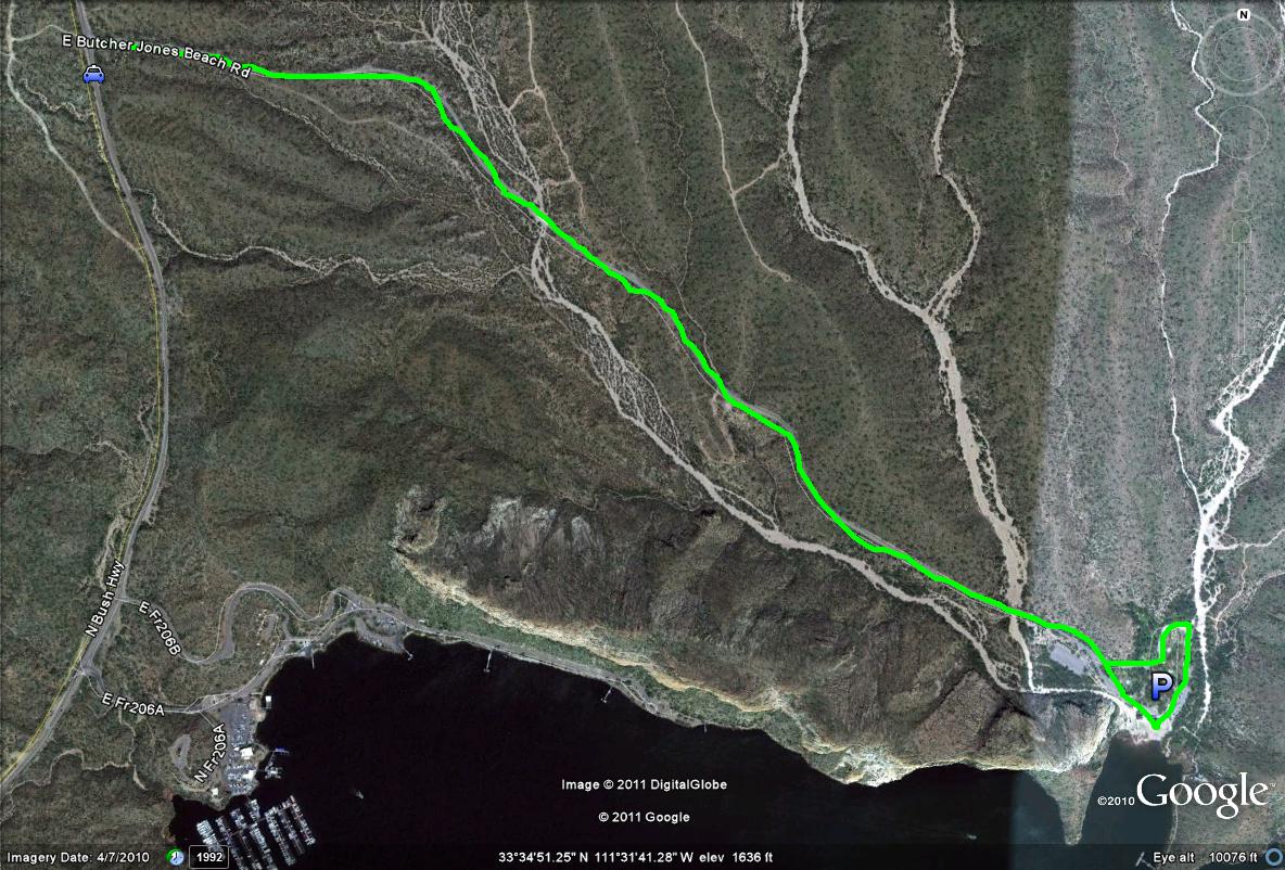
Map # 1: Entrance to the Butcher Jones Recreation Site
-The lime-green path shows the entrance to the recreation site, by taking E Butcher Jones Beach Road in the southeast direction for over two miles, all the way to the parking area and beach.

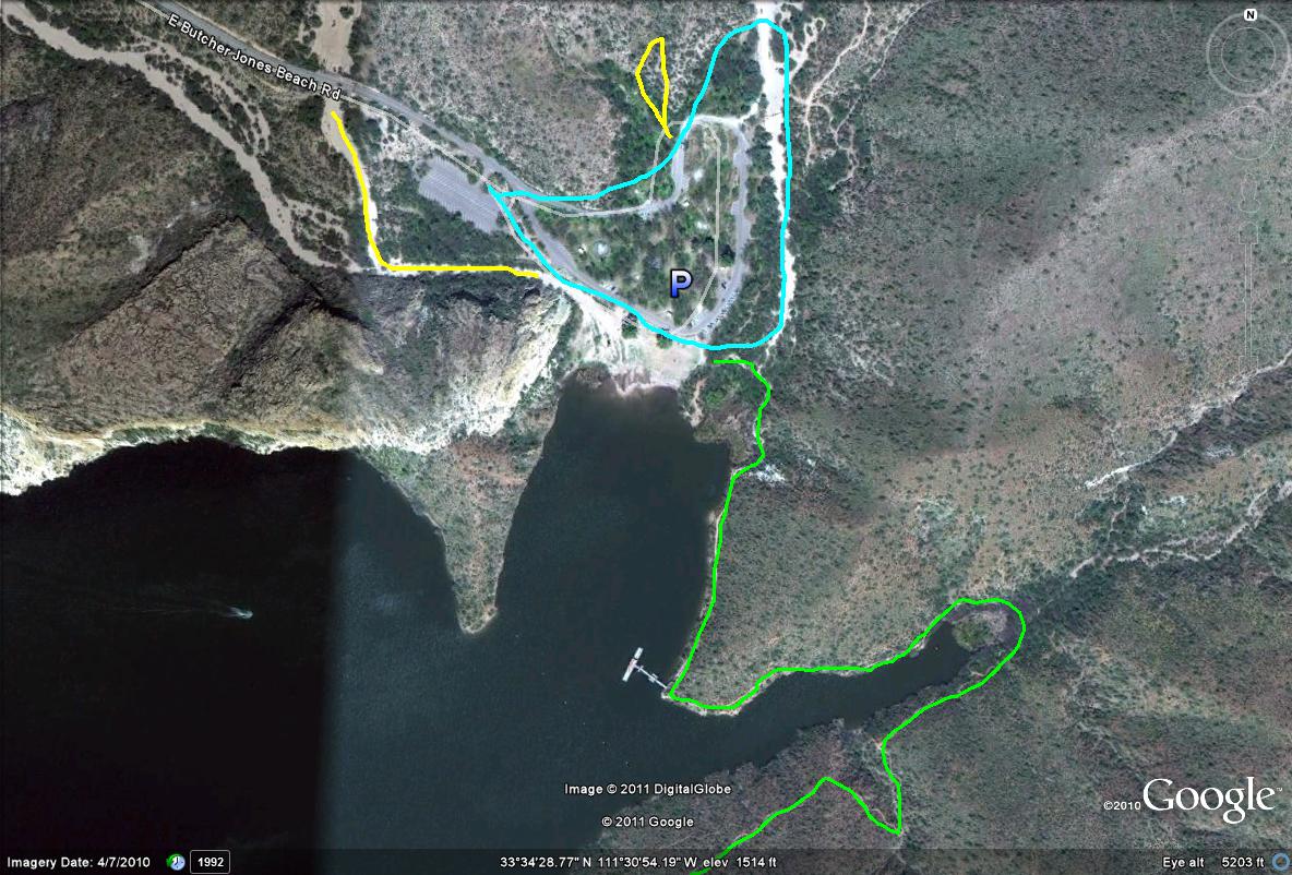
Map # 2: Birding the Butcher Jones Recreation Site
Lime-green path: Shows the beginning stages of the Butcher Jones trail, which is an excellent trail to walk along Saguaro Lake and scan for waterbirds.
Light-blue path circle: Shows the typical picnic and recreation area boundary, which is an excellent birding area.
Yellow paths/lines: Shows a two good washes that have good birding. The first is located in the southwest part of the parking lot and is easy to follow. The other one is accessed by finding the very northwest picnic site. Walk back in that picnic area, and it turns into a mini wash, where a mix a mesquite and desert birds may be seen.

| 