Tommy J. DeBardeleben
Genesis 1:21
*All maps owned by Google.
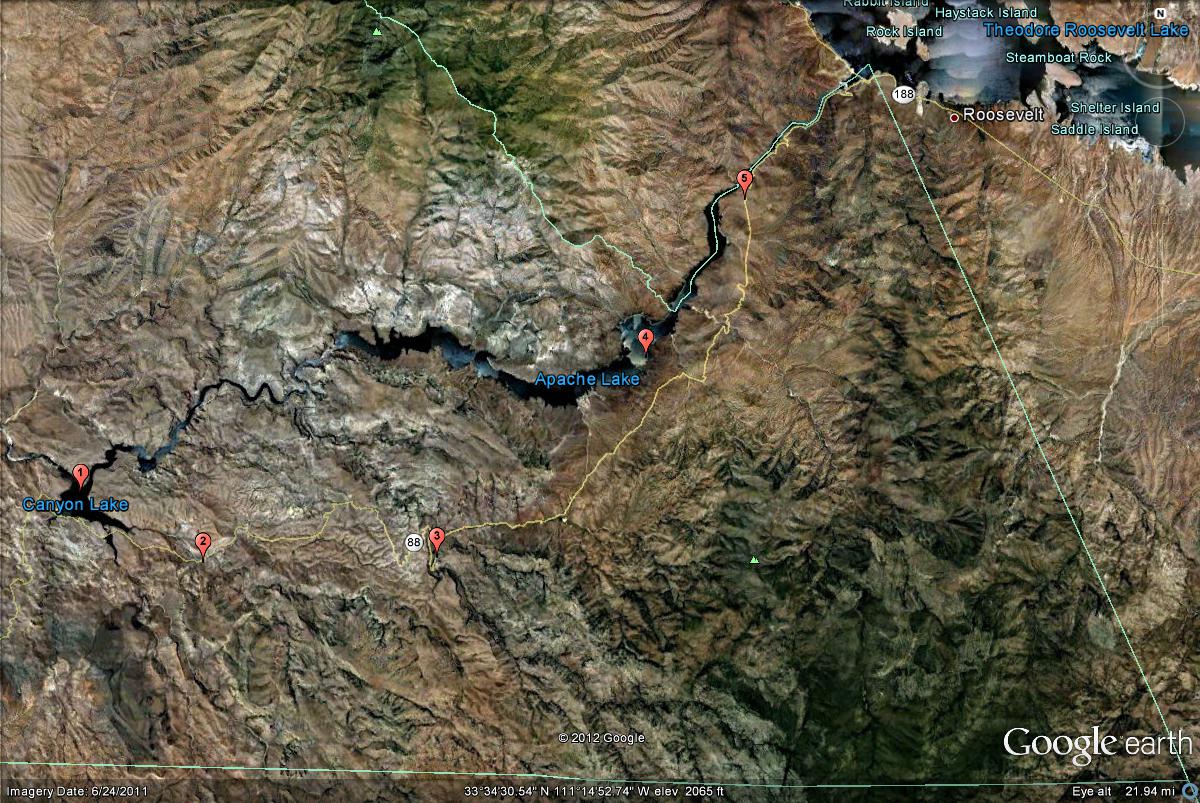
The map below shows the birding locations on the Apache Trail and their mile markers.
1. Canyon Lake (Mile Marker 209-212)
2. Tortilla Flat (Mile Marker 214-215)
3. Fish Creek (Mile Marker 224-227)
4. Apache Lake (Mile Marker 229-234)
5. Salt River between Apache Lake and Roosevelt Dam (Mile Marker 236-242)
An online guide to the birds and birding locations of Maricopa County
An online guide to Gila County Birding
An online guide to Birding in Arizona's White Mountains