Highway 87 Map Overview
*All maps property of Google.
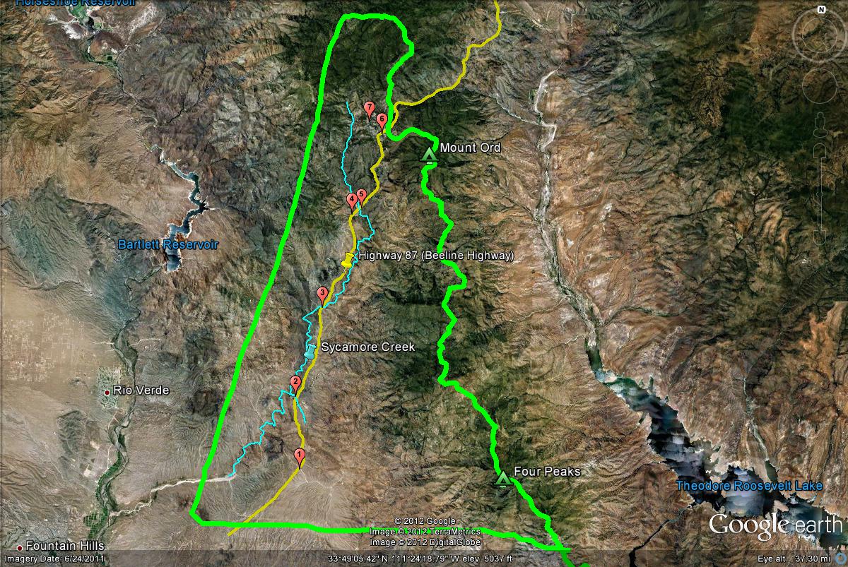
The Highway 87 "Triangle"
This is the overview of the Highway 87 Area. Other than the birding locations (represented by numbers), the yellow line indicates Highway 87, the light blue line indicates Sycamore Creek (which flows through a large portion of this area), and the lime green "triangle" shows the boundary of the overall area.
The birding locations found along Highway 87 are accessed close to the highway or can be found from roads that branch off from the highway. This refers to what mile marker from the highway that each location can be reached. The mile marker for the access point from Highway 87 are listed below for each birding location:
1. Four Peaks Wilderness: Mile Markers 203-204 (east side of Highway 87, just south of Mile Marker 204)
2. Mesquite Wash: Mile Markers 207-208 (can be accessed from both sides of Highway 87)
3. Sycamore Creek at Mile Marker 212-213: Mile Markers 212-213 (accessed from both sides of Highway 87)
4. Sunflower (Old Beeline Highway): Mile Marker 218 (accessed on the west side of Highway 87)
5. Bushnell Tanks: Mile Marker 218-219 (accessed on the east side of Highway 87)
6. Mount Ord: Mile Marker 222 (accessed on the east side of Highway 87)
7. Slate Creek Divide Area: Mile Marker 222 (accessed on the west side of Highway 87) |