Bushnell Tanks
Fast Flight Facts
Target Species: Sycamore riparian canyon birds as well as juniper species
Elevation: 3300-3600'
Habitat: Sycamore canyon riparian habitat with flowing creek, juniper habitat on surrounding hills
Overall Birding Rating: 5 (Good birding in all seasons)
Difficulty: 2 (Fairly Easy)
Birding Type: Easy to Moderate Hiking
Facilities: None
Fees/Ownership: No fees, part of the Tonto National Forest
Closest Town or City/How far from Phoenix: Sunflower (closest town); 45 miles northeast of Phoenix
Getting there: Accessed shortly to parking spot from east side of Highway 87 between mile markers 218-219
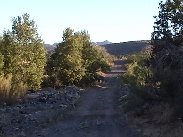
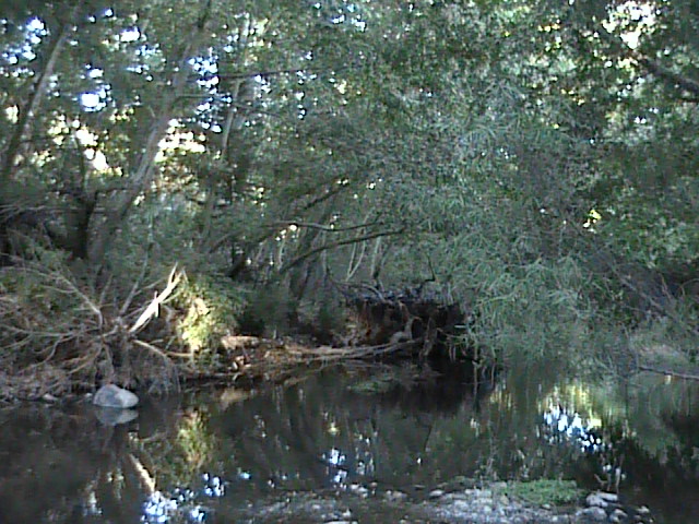
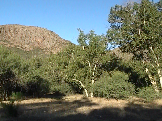
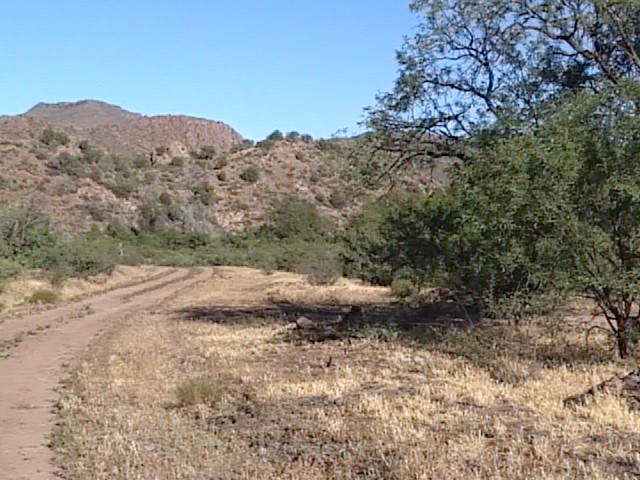
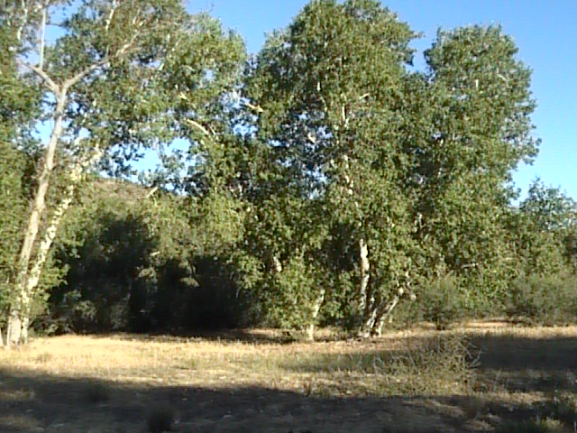
Overview: The Bushnell Tanks are another great birding area along Sycamore Creek. This site is in the Sunflower area, and can be accessed almost directly across from the turnoff to the Old Beeline Highway at Mile Marker 218 from Highway 87 (Beeline Highway). This is a beautiful area, which the main habitat consists of sycamores lining the creek in midst of surrounding hillsides filled with junipers, which includes many old growth sycamores. Willows, cottonwoods, ash, and mesquites are in the habitat mix here also. The elevation range is mostly around 3400 feet. Forest Road 22 runs east through the Tanks for over two miles along great habitat, which is a nice dirt road where foot access is only permitted. The area is closed to any motor vehicles to protect the habitat.
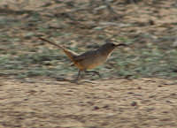
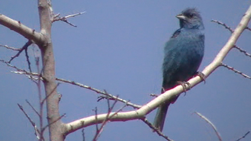
The birdlife at the Bushnell Tanks is very similar to that when birding along the Old Beeline Highway. The two riparian canyon western raptors, the Zone-tailed Hawk and the Common Black-Hawk favor this area. Both of these hawks are very vocal, and can often be located by voice. Keep an eye out for them on exposed perches alongside the creek, as well as soaring in the surrounding area and hillsides. Check Turkey Vulture kettles for any Zone-tailed Hawks in the midst. The juniper hillsides all along this area are great for the Gray Vireo, a species that is a usual target for birders in this area. This site is also a good bet for birders who are looking for Costa's Hummingbirds. Other birds typical of this habitat during the breeding spring/summer months include Black-chinned Hummingbird, Ash-throated and Brown-crested Flycatchers, Cassin's and Western Kingbirds, Bell's Vireo, Western Scrub-Jay, Bridled Titmouse, Bewick's Wren, Phainopepla, Lucy's and Yellow Warblers, Rufous-crowned Sparrow, Summer Tanager, Northern Cardinal, Blue Grosbeak, and Hooded Oriole. Indigo Buntings are also seen at times during this duration. This would be an excellent area to bird during the migrations as well as the winter months, with easily similar results to what Sunflower (Old Beeline Highway) has to offer (see the location Sunflower-Old Beeline Highway).
Birding Tip: The Bushnell Tanks is a big area with a lot of habitat to cover. A good outing will result in time well spent in the area. By taking Forest Road 22 east a few miles, it passes through great sycamore habitat as well as the juniper filled hillsides. The road branches off at parts into the hillsides, which are also worth exploring. Birding in the midst of thick sycamores can often be challenging to see the birds, and productive birding can be done by standing and waiting patiently for movement. Walk up the side roads that branch off from Forest Road 22 onto the hillsides for viewing species such as the Gray Vireos as well as Rufous-crowned Sparrows and Western Scrub-Jays. By bushwhacking and birding along the thick habitat immediately along Sycamore Creek here, the birding will also have very rewarding potential.
Directions: The Bushnell Tanks can be accessed on the east side of Highway 87 just north of mile marker 218. Once passing the bridge that goes over Sycamore Creek (well signed "Sycamore Creek" and just north of the highway's mile marker 218), the turnoff to the Bushnell Tanks are just north of the bridge. Turn east (right) into the parking area. Park and walk along Forest Road 22 a good distance to bird the area.
Pages:
Bushnell Tanks Maps
Take Me There (Google Map)
Bushnell Tanks eBird Data
Scenes and Sights from the Bushnell Tanks:
Summer Months
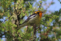
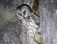
Bird Life of the Bushnell Tanks:
Indigo Bunting
Zone-tailed Hawk
Back to Area 1-Highway 87 from Desert to the High Country |